Asset
registers.


Reduce time on site with digital floor plans.


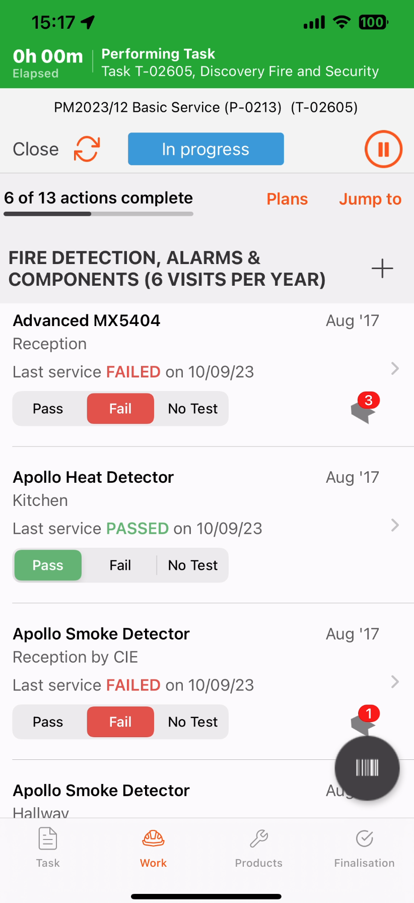
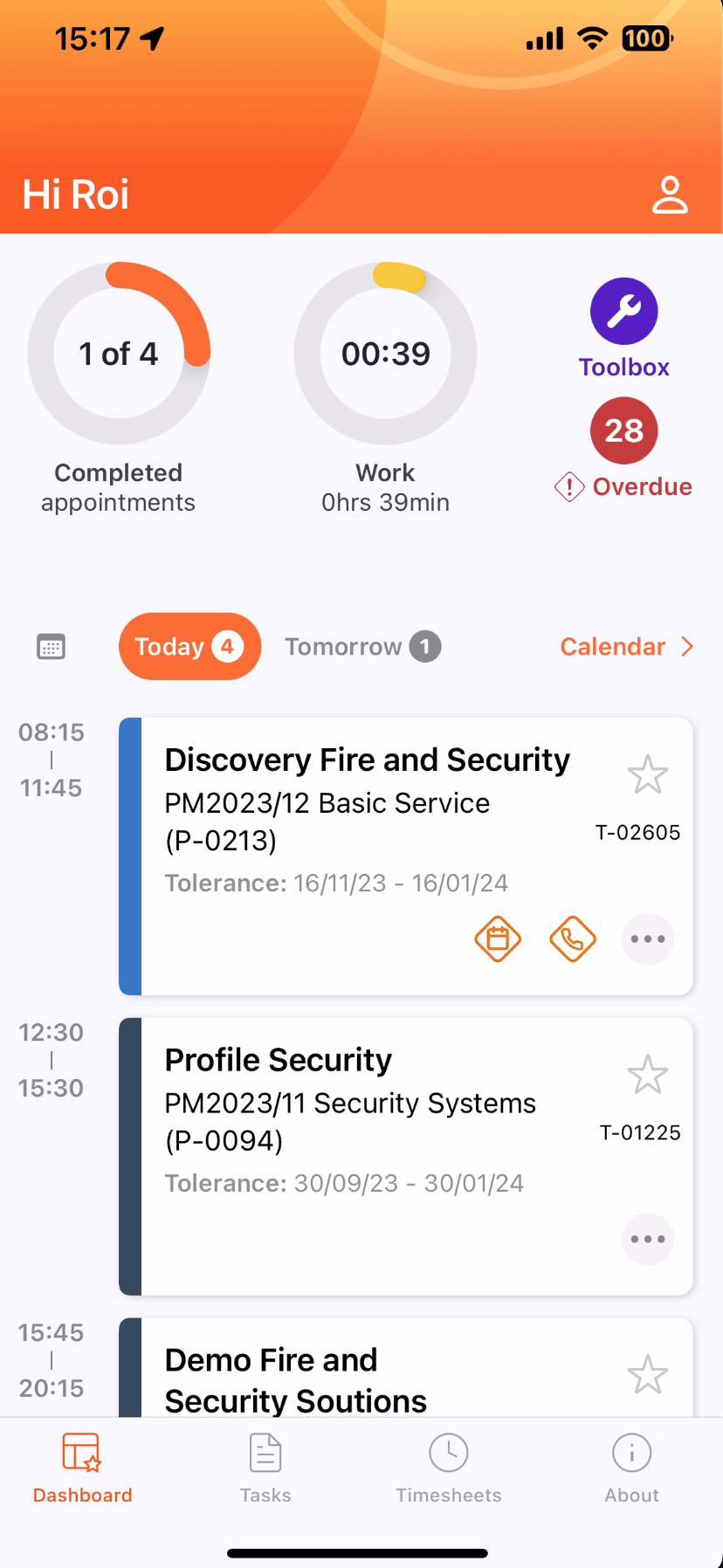
Your field teams can quickly mark whether an asset has passed inspection and add a remark through the mobile app.
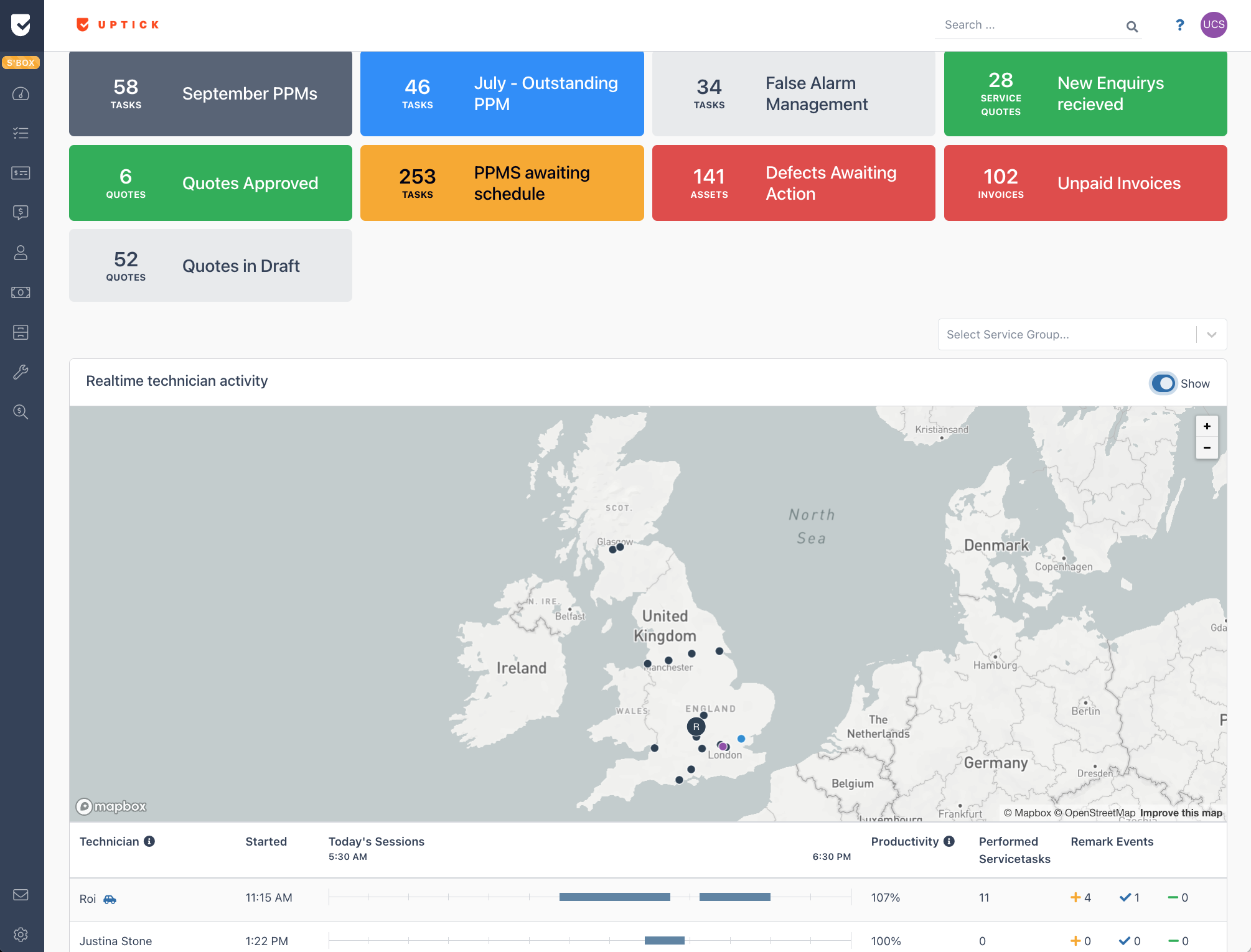
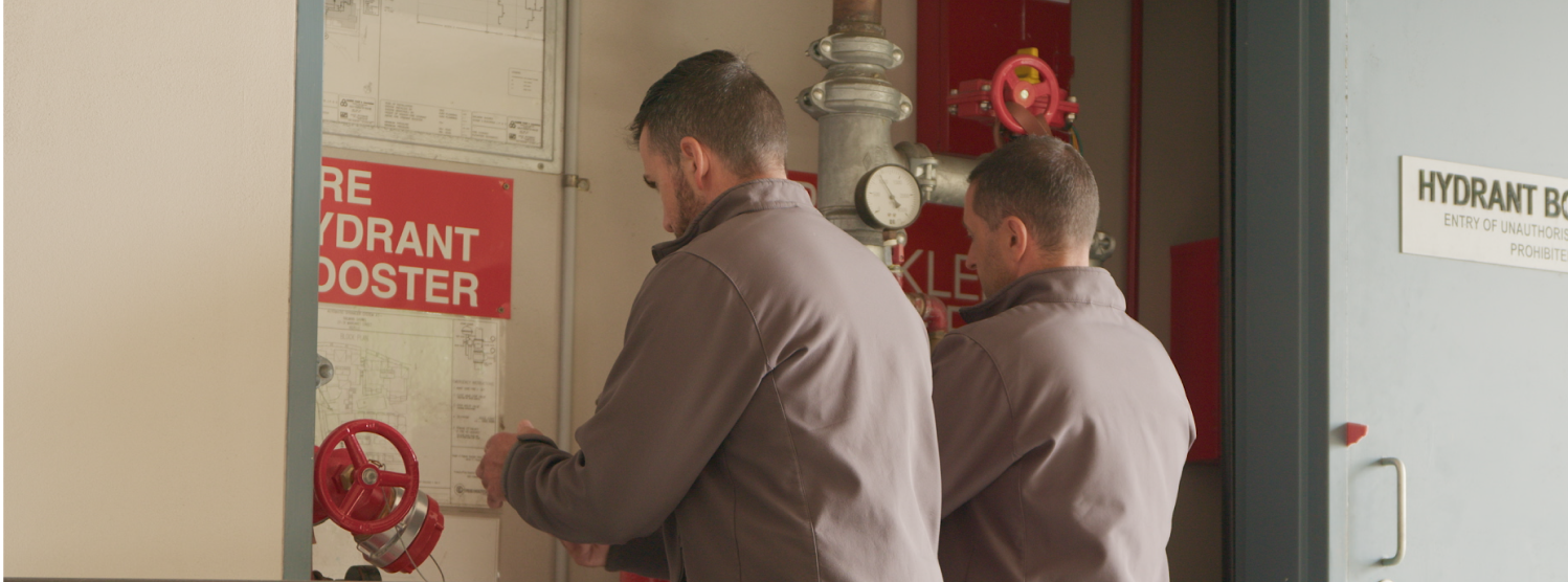
Increase efficiencies and reduce the time it takes to locate fire & security assets throughout entire buildings with the geospatial asset register.


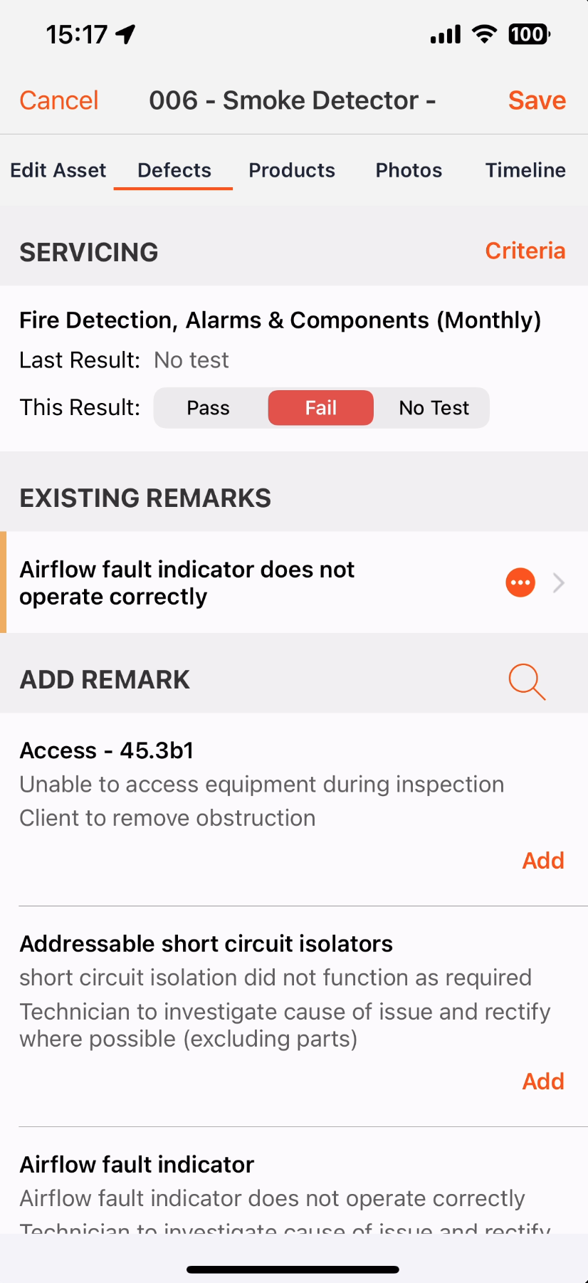
Add deficiencies from a list of common faults and take a photo. This can either be rectified immediately or suggested for a quote.


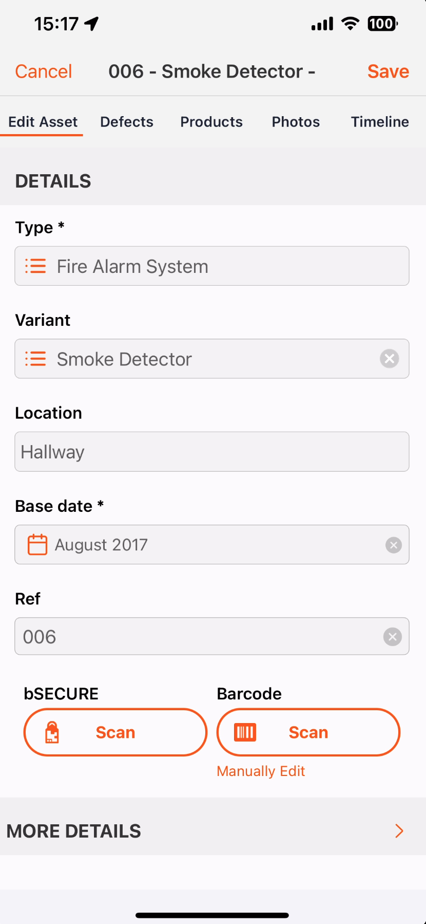
Add all asset information in the field to ensure up-to-date records are kept. This includes barcodes and location.
Built for the Fire Protection industry.


Here’s how Full Range Fire Safety did it.
Full Range Fire Safety knew that having technicians make the most of every minute spent on services and repairs is the most scalable way to increase profit margins.
With Uptick they were able to decrease time spent looking for assets and prepare service reports directly on-site, reducing turnaround time.
Fire industry leaders
choose Uptick.
Frequently asked
questions
Operate with confidence.